|
||||||||||
|
||||||||||
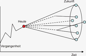
GLOWA-Danube results and key messages1. IntroductionIn order to investigate the regional effects of climate change in the Upper Danube catchment, the integrative decision support system DANUBIA was developed, which consists of various natural science based and social science based submodels (see chapters E2 to E4 and 2.1 to 2.12). Several impacts on water resources were simulated using an ensemble of scenarios for the future development of climate and society, which spanned a feasible range of possible developments.
The main focus was placed on examining the natural resource water and on its usage. The climate scenarios developed cover the time period 2011-2060, and they are based on the moderate A1B emission scenario from the IPCC. The following statements summarize the results of the GLOWA-Danube research project. 2. The methodological approach of GLOWA-DanubeBoth the regional impacts of climate change and
the potential adaptation strategies are complex
due to the multiple linkages and interactions
between climatic, geographic and social factors.
These linkages are responsible for often unrealistic
and sometimes impossible analyses of direct
cause and effect. To take these linkage requirements
into consideration and to respect possible
interactions, DANUBIA was developed as a simulation
tool, from scratch. For this purpose, the
latest software tools, such as Unified Modelling
Language (UML) and parallel distributed computing,
were used. The development of DANUBIA
was completed successfully. It has proven itself
as a flexible framework to couple the various
submodels of the different disciplines involved in
GLOWA-Danube and their interactions. Meanwhile,
the framework has proved its operational
capability in a variety of different applications. 3. The regional development of climateAlready in the past, a significant rise of surface air
temperature in the Upper Danube watershed was
shown (see chapter 1.9). The measured temperature
increase in the Upper Danube was an
average of 1.6°C, which is more than twice as
high as the global average. The cognition of the
future temperature trends spans a wide range of
scenarios beyond this general increase. The likely
temperature increase ranges between 3.3°C
and 5.2°C over the period 1990 to 2100 (see
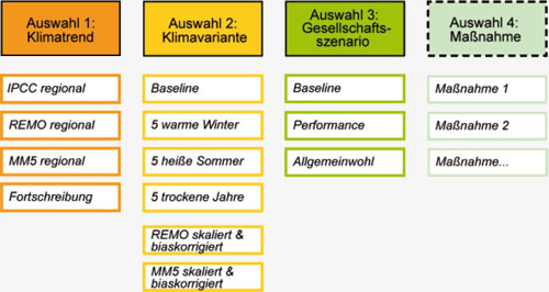
chapter S1-S5). 4. The development of societyThe social scenarios in GLOWA-Danube are based on the so-called social megatrends from SinusSociovision, which refer to the situation of the society as a whole and its change in the future. Thus, the social scenarios hold a correspondingly high level of abstraction. To implement these in GLOWA-Danube, a specification of the megatrends was developed, through a concrete, substantive expression in every involved subproject. For the development of the social base orientation towards the future, three scenarios were developed which take into account inter alia new technologies, the globalisation as well as demographic, economic and political decisions (see chapter S6). The scenario baseline depicts the current status quo and represents this status quo in the future as well depending on the submodel. The scenario public welfare describes a society, which is characterised by a return to the responsibility of the whole society and by placing a high value on the common good and sustainable development. The scenario open competition describes the opposite trend to the scenario public welfare. In this scenario more emphasis is placed on economic efficiency and the performance of the individual.
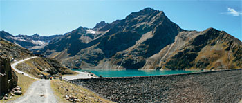
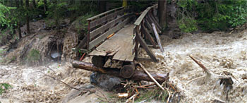
5. Water balanceThe simulated results show, the water availability in the Upper Danube will decrease during the
period 2011-2060 but it will not become scarce
(see chapter 3.1.1). Comparing the period 2036-2060 with 1971-2000, a decrease in water availability
is found which varies between 5% and 25%
depending on the climate scenario.
The low flow at the gauge in Achleiten near
Passau will be reduced by 25% to 53% by the
year 2060. In combination with increasing water
temperatures, this may result in a reduction of the
availability of water for cooling thermal power
stations, and to limitations for shipping in the
summer (see chapter 3.1.2 and 3.1.9). A strong
reduction in the low flow discharges along the
Danube is expected on the one hand, while an
increase in the low flow discharges in the Alpine
valleys is expected on the other hand. Reasons
for this are due to the complex interaction between
a higher proportion of precipitation expected
to fall as rain in winter, and an increased evapotranspiration
with reduced rainfall in the summer.
The increased proportion of rain and snow melt
contribute to an increase of low water flows in the
Alpine valleys, while the higher evapotranspiration
and decrease in precipitation in the summer
are conducive to accentuated low-water situations
in the Alpine foothills and in the northern part
of the Upper Danube catchment.
The electricity generated from the installed hydropower plants is a main source of renewable energy in the Upper Danube catchment. The amount of electricity generated will be significantly reduced, due to the decrease in runoff in the future, the extent of which varies, depends on the chosen future climate scenario and the subcatchment considered. The decrease is particularly strong after the occurrence of several consecutive dry years. In the southern area of the watershed the drop in hydropower energy production is attenuated in the first scenario years because of the melting water from the glaciers.
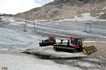
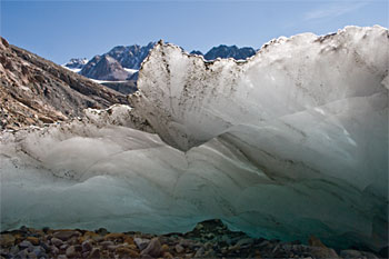
Indeed, the glaciers in the catchment of the Upper
Danube will have disappeared almost completely
between 2035 and 2045. The simulations
show that the water stored in glaciers at present cannot provide an essential water contribution to
ensure a balanced water management in the
Upper Danube catchment. However, the melting
of glaciers will lead to a slight increase in discharge
in Passau of about 2% during the period 2011-
2035. In these headwater regions, the glaciers
therefore make a non-negligible contribution to
the increase in the low-flows during this period.
After the year 2035, the reduction in the quantity
of the melt water from the remaining glaciers
contributes to the general decrease in runoff (see
chapter 3.1.4).
The results presented show the partly severe consequences of climate change on the water resources of the Upper Danube. The water supply to the downstream users, who depend on the Danube river water and who use it intensively, will be moderately to significantly reduced in the future. The synopsis of the results shows that the role of the Upper Danube as a "surge chamber" for the Danube downstream users should be reevaluated for the future. 6. Water consumption and water supplyThe simulations of the water consumption behaviour of households show that the private per capita consumption of water in the Upper Danube basin during the period under consideration, from 2011-2060, will be significantly reduced.
In the second half of the simulation period, a
significant slowdown of this reduction is observed.
The decrease can mainly be attributed to
a widespread implementation of water-saving
technologies in households and the changing
consumer behaviour. The adoption of watersaving
technologies varies depending on innovation,
environment and social scenario. In some
cases even, a universal spread of technologies is
achieved. The decline in the per capita water
consumption is partly compensated by the rising
population numbers at the beginning of the
simulation period. However, overall, the simulations
show a decline in private drinking water
consumption by about 20% to 25% until 2060
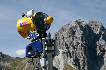
(see chapter 3.2.4 and 3.2.6). 7. Winter and summer tourismThe changes in winter tourism are characterized by dwindling snow cover durations, depending on regional and elevation factors. This may span 30 to 60 days, depending on the chosen climate scenario. The diminishing guaranteed snow cover at lower elevations intensifies the concentration of winter tourism at higher located and welldeveloped ski areas with adequate infrastructural facilities. In these skiing areas, due to the increase in precipitation expected in winter, the snow conditions will not deteriorate despite higher temperatures. In fact, snow conditions may even improve in some regions. However, a decrease in the number of optimum skiing days is expected in the whole study area. Optimum skiing days are characterized by different factors, such as a lack of rainfall, adequate snow cover, sunshine, little wind speed and pleasant temperatures.
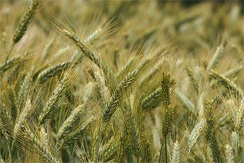
Due to the high investment costs for producing artificial snow, and due to a lower guarantee of snow cover, an economically viable operation will not be able to be sustained in some low-lying ski areas; especially since the advent of higher temperatures will often cause the use of snow cannons to be impossible. In the second half of the simulation period, depending on the chosen climate run, between 20% and 50% of today's ski areas will no longer be able to secure their existence through ski tourism (see chapter 3.2.1). As a result of higher temperatures in the summer, locations with a high percentage of holiday travellers may reckon with a growth in the number of visitors, which may compensate for the losses experienced during the winter season, to some extent. Climate change therefore also affects summer tourism, although to a lesser extent than the winter tourism. 8. Agriculture and ForestryAll of the investigated climate change scenarios show that the increasing atmospheric CO concentrations and the higher temperatures will lead to an increase in crop yields (see chapter 3.3.1). The water use efficiency of the vegetation (ratio of biomass production to water transpired) will improve significantly for C plants. Thus, transpiration amounts do not increase proportionally to the amount of biomass produced. Occasionally there may be reductions in the crop yields grown on light soils, during dry years as a consequence of soil drying, especially along the Danube river.
The mineralization of organic matter in the soil will
increase. Thus, the soil nitrogen availability will
improve, provided that the soil contains sufficient
organic matter. These effects, which are influenced
inter alia by the temperature increase of the
upper soil layer (see chapter 3.3.2), vary to
different degrees, depending on the local climate
factors at a small scale. 9. Industrial water usageThe vulnerability of the industrial sector to climate change can be assessed as being low in the Upper Danube catchment. There are solely regionally limited losses of growth, of up to 0.4 per mill per year. In some regions, economic growth even benefits from climate change. The industry responds to water shortages foremost by optimizing their processes and subsequently with circuit or multiple uses, and thus they can avoid a production constraint as a consequence of a resource shortage (see chapter 3.2.5).
zurück zur Einleitung-Übersicht
|
||